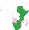
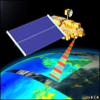
RCMRD GeoPortal

RCMRD GeoPortal is a platform for disseminating open geospatial datasets and maps for the Eastern and Southern Africa region. RCMRD has partnered with SERVIR-Eastern and Southern Africa to develop the platform for improved utilization of geospatial data within member states to enhance decision making.

Datasets

Click to search for geospatial data published by other users, organizations and public sources. Download data in standard formats.

Explore data »

Maps

Data is available for browsing, aggregating and styling to generate maps which can be shared publicly or restricted to specific users only.

Explore maps »

MODIS Data

Discover daily MODIS Terra, Aqua and VIIRS data products.

Explore data »